No asshole cabbies or goofy teens calling me "grandfather" today, and I think I dodged a bullet by not going to my planned stop, Geumgang Oncheon Motel. Oncheon is from the same two Chinese characters pronounced onsen in Japan, the difference being that, in Korea, the term refers more to a hot, steaming bath or sauna than to literal hot (on) springs (cheon) with cute, pink-faced monkeys in winter. I saw the Geumgang Oncheon Motel as I approached, and I realized right away that it was going to be expensive. Luckily, the Crystal Motel was right next door and only W40,000 a night. I'm here now; it's decent, and my room has WiFi. The room's mirror has stickers on it showing the WiFi service and password, so hooking into the system is no problem.
Unfortunately, the convenience store across the street doesn't open until after 6 p.m., so I'm typing out this entry while I wait. In theory, that convenience store, an eMart24, is open all day and all night, but because the store is located on a traditional hanok property, the only people who can access the store when it's unstaffed are the hanok vacationers, who are given access codes so they can pop in anytime. I'll be going there when I'm done with this entry.
But perhaps I should start at the beginning. I deliberately got up later this morning, thus allowing myself to sleep a little more, to start the day later, and to walk at a more relaxed pace.
Today's walk had a few slow, steady rises and dips, but near the end, it was characterized by relentlessly flat straightaways. I walked very slowly, sorely missing the usual extra day of rest I normally give myself after a segment of 30K or more. There were times when my pace was down to 2 kph—a crawl. I'm telling you: never walk with me. You'll go crazy. Aside from health, another reason why I'm slow is that my backpack this trip is substantially heavier than the one I normally use.
Things didn't get really interesting until I reached the city of Gongju, which I didn't even know existed until recently. Gongju is known for a famous king and his burial mound, as well as for an impressive fortress that looks to have been featured in any number of historical dramas. Gongju is very nice, very impressive, and very tourist-trappy. The city is begging to be explored, but it's also somewhat tacky and, like some women, overly made-up. That said, I'd like to come back here and explore a bit.
So today's 20 km felt a lot like yesterday's 30-some kilometers. Tomorrow's going to be around 30K as well, so I'll be starting early so as to finish early.
Ah—there was, come to think of it, one weird incident today: I was trying to photograph a rather artistic-looking garbage pile when a biker crashed into the pile, ruining my photo. Not wanting the guy to lose face for his blunder, I apologized, and the guy grandly said it wasn't a problem. The guy's friend, who had passed me from behind by using the right lane, was ahead. He came back to check on his friend, and I gathered that my guy had been trying to pass me by slipping between me and the garbage pile. Pretty stupid when you think about it. And definitely not my fault despite my face-saving apology. Still: no skin off my balls, as a Kiwi buddy of mine used to say.
Here are your ten images for today.
 |
| As always, ignore the distance. |
 |
| Coupling Motel |
 |
| morning sun |
 |
| the Devil got benched |
 |
| kitty witnesses the crash |
 |
| the now-rearranged artistic-looking garbage pile |
 |
| fence decorations for an ancient-history museum |
 |
| museum with a mammoth-hunt tableau |
 |
| teacher/scholar? king? |
 |
| boid |
 |
| artistic decay |
PHOTO ESSAY
 |
| Coupling Motel sign, 6:19 a.m. |
I woke up late and started out the door late because I knew today's walk would be shorter than yesterday's. It still ended up feeling long.
 |
| development is always happening in cities |
 |
| Equipment comes from all over. |
 |
| re-crossing the creek to get back on the path |
 |
| over the Aragorn/Arwen bridge |
 |
| crick, looking right |
 |
| crick, looking left |
 |
| crick, looking left but with no railing in view |
 |
| May you never dry up. |
 |
| the tucked-away shwimteo |
 |
| I could either go up the stairs to the street level or head up the bike ramp. I chose the ramp. |
The bike ramp turned out to be frosty and a bit slippery.
 |
| —but the ramp was easier to walk up, and I was feeling my morning laziness. |
 |
| a familiar sight to my Amurrican readers |
Costco Korea sells a lot of Korean products, but it also sells plenty of authentically American products and not just cheap Korean knockoffs. The bagels and baked goods are about the same as what you'd get in America, but the range of the selection might depend on the size of the Korean Costco you're visiting. Some Costco branches are physically huge, thus offering huge variety; others are smaller and therefore somewhat more limited.
 |
| looking back |
 |
| looking ahead |
 |
| well, well |
 |
| and the requisite litter |
 |
| bike trail |
 |
| coming up: the Hangnarae Bridge (Hangnare-gyo/학나래교) |
No idea what Hangnarae means.
 |
| We're going to go down and cross under. |
 |
| interesting split-level structure for walkers (and, presumably, bikers) |
 |
| down, down, down |
 |
| not much under-the-bridge culture going on here |
 |
| but plenty of places to sit |
About here, I got disoriented trying to figure my way down to the path. I eventually found the ramp leading down (see pic below). It was, yet again, a very cold morning. On cold mornings, you really don't want to spend a lot of time blundering about and acting lost. Confusion doesn't make you warmer. Walking forward does.
 |
right-side sign: "No 2-wheeled or 4-wheeled motor vehicles."
left-side signs: "Danger—frost area. Watch out for slippage." |
 |
| passing out from under the bridge |
 |
| the trek continues |
While this terrain has more ups and downs to it than other paths I've done (those paths are usually 90% flat, but with the occasional, scary-steep and/or scary-long hill), the views along the way are generally good. And in the morning, things are more serene.
 |
sign facing my way: "Geumgang Estuary Barrage, thataway."
signs facing opposite my direction of travel: "Daecheong Dam, Sejong Dam Cert Center" |
 |
| This could become a desktop background. I like these "stretching into the distance" shots. |
 |
| Good morning, deity. |
 |
| Yongsu Creek Footbridge |
 |
| We cross the footbridge. |
 |
| In a couple of hours, it'll be warmer. |
 |
| where the water flows |
 |
| cast-off mystery equipment |
 |
| pulled back for context |
 |
| Wow. Paths of similar quality for the moment! |
 |
| 107K to go to the end... which I will not reach, alas. |
 |
| going slightly up, then passing under that bridge, the Geumgang Bridge (Geumgang-gyo/금강교) |
Don't get confused—a lot of bridges have similar names because the people who name them aren't very creative. We'd gone over the Geumnam Bridge (금남교/Geumnam-gyo) yesterday; ahead is the Geumgang Bridge (금강교/Geumgang-gyo). Listen carefully to the syllables, distinguish the vowels and the consonants, and you'll mentally hear that it's not all ching-chong, ling-long, ting-tong. There's actual meaning there, in every phoneme. Believe me, Korean EFL students are driven as crazy by English as you are by whatever Asian language you're learning. Ask a Korean student to pronounce anything in English with an f, a v, a th, a zh-sound (pleasure, measure, incision), or a word beginning with a woo or yi sound (woman, year*). Ask Koreans to distinguish between beat and bit, heat and hit, sheet and shit. Now flip the question around and see whether you can hear the difference between Korean single consonants and double consonants, like si versus ssi, or gan versus ggan. Or distinguish hard sounds from soft sounds, like b versus p, j versus ch, etc. English-speaking learners of Korean mess these up constantly. It's a two-way street. Both sides of the ocean are retarded about the other side's language. Upshot: What may sound like a load of gibberish to you really isn't. It just takes time, effort, patience, dedication, and lots of exposure to start to learn the differences. Years later, I still make embarrassing mistakes. Then again, I'm a slower-than-normal learner.
*If Koreans can't pronounce a yee sound, why do so many of them have surnames romanized as "Yi"? Because in Korean, it's pronounced only as "Ee." So that Korean guy whom you've been addressing as "Mister Lee" or "Mister Yi" in your American accent is really "Mister Ee" in his own tongue.
 |
| passing under, and another warning sign about "no passage in severe weather" |
 |
| the vanishing-point perspective shot |
 |
| past the bridge and onward |
 |
| Always interesting to me is how the path constantly changes character. Path, road, field, open area... |
 |
| Mr. Straightaway |
 |
| glove, with context |
 |
| up close, with a little help from digital zoom |
 |
| Satan's own bench |
 |
| stopping here for a bit and noting how a shadow can affect temperature and moisture |
 |
| a nursery with nothing in it yet |
 |
| curving left |
 |
| looking riverward |
 |
| looking more riverward |
 |
| thataway, with 7% grade downhill |
 |
| better downhill than uphill |
 |
| Development never stops. |
 |
| another candidate for desktop wallpaper |
 |
| the shadow shot |
 |
| 9:22 a.m. |
 |
| Just wait'll it all grows back. |
 |
| up ahead: Bulti Bridge (Bulti-gyo/불티교) |
 |
| traces of town |
Today's walk takes me out of Sejong City and into Gongju City (Gongju-si/공주시/公州市), bastion of Baekje Kingdom culture. The hanja for Gongju, as you see, is 公/공/gong, meaning "fair, impartial" + 州/주/ju, meaning "village."
There's another gongju, meaning "princess," written this way in hanja: 公主, meaning "fair master/leader." And since we're on the topic, a prince is a wangja/왕자/王子, or "king-son." (So, yes: wang means "king," not "penis.") Interesting asymmetry: the male designation has nothing to do, etymologically, with the female designation.
 |
| Just enjoy the scenery. |
 |
| almost at Bulti Bridge |
 |
| We pass under, go up a ramp, and head across the bridge. |
 |
| the gently sloped ramp up |
 |
| at the ramp's top |
 |
| not many people in the lot at 10:00 a.m. |
 |
| about to cross |
 |
| a last look before crossing |
 |
black sign: Bulti Bridge
green sign: Janggun Township |
 |
| Bulti-gyo sign up close (there's another one on the other side) |
 |
| Bridge specs. The bridge was constructed from December 1998 to July 2002. |
 |
| another angle |
 |
| not much room for both bikers and walkers simultaneously |
 |
| There he goes. |
 |
| The superstructure gives this the feel of a rail bridge. |
 |
| A huge flake of paint fell off (left). |
 |
| almost across |
 |
| We're heading to Gongju. |
 |
| and down another ramp |
 |
| not far from here, a calamity occurred |
 |
| cafes and such on this side; and on the riverward side, an artistic pile of garbage |
 |
| stairs and bridges: cute and quaint |
 |
| But are the flowers real? I doubt it. |
 |
| for you coffee lovers |
 |
| traipsing along, not knowing what's about to happen |
 |
| bluff peaks across the river |
 |
| I hear Howard Shore's music. |
 |
| I can imagine dwarves under the mountain. |
 |
| Always they sit, crouched and waiting. The mountains, I mean—not the dwarves. |
 |
| See the cat in front of the pavilion? |
 |
| closeup, digital zoom |
 |
| Shwimteo? It's big. |
 |
| And there's writing on it. |
 |
| Sorry—no idea what that says. |
 |
| at last: the artistic pile of garbage (10:28 a.m.) |
The biker crash took place between the above photo and the photo below. I was standing at the garbage pile, in the left lane, aiming my phone camera at the pile. The biker and his friend bore down on me; the friend stayed in the right lane, smoothly going behind me. For whatever reason, the main biker tried slipping between me and the garbage pile despite there being almost no room to do so. Result: he crashed into the garbage pile, missing me entirely. The whole scene looked idiotic, but I apologized as though the whole thing had been my fault. In reality, he could have decelerated and passed behind me as his friend had. Anyway, he crashed into the garbage before I'd had a chance to take a photo of what had been perfectly piled refuse. What you see below is the crash's aftermath.
And no, of course I didn't take a pic of the biker. If that'd been me, I would never have wanted my blunder to be recorded.
 |
| 10:29 a.m., post-crash |
 |
| Unmoved by events, the mountain just calmly stares. |
 |
| The bikers bike on. |
 |
| another desktop-wallpaper-worthy image |
 |
| 101K to go |
 |
| back to Bulti Bridge, or onward to Cheongbyeok Bridge (Cheongbyeok-daegyo/청벽대교) |
Onward!
 |
| Cheongbyeok Bridge in the distance |
 |
| I have a Korean cousin who studied civil engineering. |
 |
| nearing the next bridge |
 |
| Cheongbyeok Bridge, looking left and riverward |
 |
| looking straight ahead |
 |
| moving beyond |
 |
| friendly reminder of what route I'm on |
 |
| "Sharp Curve. Go slowly." |
 |
| The road goes ever on and on. |
 |
| The composition is wrong: less ground, more sky. |
 |
| Did people build a cairn (tap/탑) at the bottom of a sign? |
 |
| Now entering Gongju City. |
 |
| boundary line |
 |
| I stopped at this altar-looking stone table in a park, ready to sacrifice Aslan. |
 |
| ate my last jerky there before moving on |
 |
| more mysterious than a crop circle |
 |
| the chair on the steep hill |
 |
| ever onward |
 |
| I'd thought the border was back a ways. |
 |
| But here we are. |
 |
| mountainside graves |
 |
| wide shot for context |
 |
| more like homes than offices...? |
 |
| another set of graves |
I'd been wondering when I'd start seeing these myo (tumuli, burial mounds).
 |
| always changing character |
 |
| someone's property |
 |
| up the hill |
 |
| I took it slow, stopping often. Didn't want another heart attack. |
 |
| It's 12:02 p.m. and warm out. |
 |
| the images on the fence: rock/boulder |
 |
| the images on the fence: primitive humans |
 |
| the images on the fence: two rocks/boulders |
 |
| getting to the top, but... |
 |
| —there's the imprint of a dramatic death. A slug that dried up before making it to the low wall. The track tells the story. |
Strange how, so often, life comes down to a race against the sun.
 |
| Sorry, little one. Your story ends here. But as you fray and fade into the Tao, your echoes will go on. |
 |
| creepy elf-things up ahead |
 |
"Greetings, humans!
|
 |
| "Don't mind us and our lack of noses!" |
 |
| stairs up the slope |
 |
| Up and down twenty times a day would be a good workout. |
 |
| onward |
 |
| Seokjang Village Museum |
 |
| still under construction, whatever it is |
 |
| You can hear the hammering and the clanking and roar of machinery. |
 |
| Another biker blows by me. |
 |
| a sign for the place guarded by the Noseless Ones |
 |
| wide shot |
 |
| another yellow museum sign |
 |
| downhill toward the exhibition space |
 |
| good tobogganing in midwinter... until you reach the bottom |
 |
| elderly-protection area: 30-kph speed limit |
 |
| We're under the 100K mark now. |
 |
| I think this is a museum about ancient human activity and societies. |
 |
| See the huge replica of a stone axe? |
 |
| and another |
 |
| I'm not going in the museum, though: I'm going past it. |
 |
| mammoth tableau (pit trap?) |
 |
| Will the spear do its fell work? |
 |
| last resort: ancient taekwondo |
 |
| Or maybe this guy is Korea's answer to Chuck Norris. |
 |
| I have a sinking feeling that the rock isn't quite enough. |
 |
| There's a lot at stake, and this ain't the Olympics. |
 |
| of course: some semi-abstract art |
 |
| ah, an archeological site |
 |
| et voilà |
 |
| My walk takes me past the museum's entrance: "Seokjangni Museum." |
 |
| ever forward |
 |
| But we must pass Yoda's abode. |
 |
| Yoda's kind of a hillbilly. |
 |
| Howdy, y'all! Come on up the back way! |
 |
Scrawled on the stone, it says (L to R): "Route to climb up to the bakery! Drinks, coffee, dumplings... careful on the stairs." |
 |
| Down the road I go. |
 |
| Liquid... Propane... Gaaaaaaasssss |
 |
| They're all sellin' it... we're all huffin' it... |
 |
| rest area, 50 m ahead (pointing back the way I'd come) |
 |
| staying left |
 |
| proceeding on |
 |
| another route marker (I've passed several that I didn't photograph) |
 |
| My feet are starting to hurt despite today's shorter distance. |
Normally, when I do a segment that's over 30K, like yesterday's, I take a day off to allow my feet to rest. When I planned this walk, though, I arrogantly thought I could brute-force my way through a mere five days of walking in a row despite two or three days of 30K or more. Ha! Folly.
 |
| Pain or not, onward I go. |
 |
| Danger Guy demonstrates the need to watch for falling objects. |
 |
| at a guess, a drainage gate (baesumun/배수문) and a pump station (peompeu-jang/펌프장) |
 |
| Rivers and even some creeks have these all along their length in Korea. |
 |
| The trail widens out a bit. But still no pedestrian lane. |
In the US, we're taught to walk on the left side in the absence of a dedicated lane for walkers. Better to see and deal with oncoming traffic.
 |
| another building-dick trying to hide in the grass (naughty, naughty!) |
 |
| hung like a bear |
 |
| precursors of spring? |
 |
| 12:57 pm.—gravesite way in the background (clearing on that mountainside) |
 |
| wallpaper |
 |
| Under the "95 km," it says "금강하구둑." |
So maybe I should explain. At the very end of this path, in Gunsan, is something that's dam-like but not exactly a dam: it's a barrage, more of a French term than an English term but not unheard-of in English. The endpoint of this trail is designated as the 금강하구둑, or Geum River Estuary Barrage. I've seen pics of it; it looks a lot like the estuary barrage at the end of the Nakdong River in Busan, a structure I've seen many, many, many times over the years. Like a dam, this structure has sluice gates to control water flow from the river into the sea. Like many dams, the estuary barrage is usually big and wide enough to have its own road surface crossing over it. For bikers, there will be—on one side of the structure or the other—a certification center, i.e., a red phone booth where a biker can walk inside and place the final stamp inside the official passbook where he's been collecting all of the stamps on his journey. I've never gotten an official passbook because I'm not a biker, and I'm not interested in receiving certificates of achievement. I do, however, normally collect stamps the first time I do a trail. I guess this time was an exception, given my poor start the day before. When I finally re-plot my course and do this trail right, I'll come back with my Moleskine notebook and collect the stamps I missed this time. As for the Korean terminology mentioned above, it breaks down like so:
금강하구둑/Geumgang haguduk = Geumgang (Geum River) Estuary Barrage
금강/Geumgang = Geum River (Geumgang)
하구/hagu = estuary
둑/duk = barrage
In the pic above, you may have noticed some writing beneath all of that.
기점/gijeom = starting point
종주 노선/jongju noseon = end-to-end trail route
So that estuary barrage, which I'm treating as an endpoint, can also be thought of as a starting point. I hope that demystifies what's on these blue kilometer markers.
 |
| coming up: New Gongju Bridge (Shin Gongju-daegyo/신공주대교) |
 |
| tall but not very wide |
 |
| so almost no "bridge culture" underneath |
 |
| But there's always that cathedral-like géométricité. |
In case you haven't figured it out, j'étais prof de français dans une autre vie, il y a très, très longtemps. Mais bloguer le reste de ce blog en français serait sans doute pénible pour la plupart de mes lecteurs, donc that's why I blog mostly in English. And even after decades in Korea, my French remains ten times better than my Korean.
You do know the quick way to translate foreign-language text, yes? Use your mouse to select the foreign text, then right click, then click on "translate selection to English." And if you're on Chrome, a little Google Translate window will pop up with a translation. I don't know how it works for other browsers, but try this trick with the French I'd written above.
 |
| moseying on |
 |
| down a wee bit |
 |
| across a tributary in a moment |
 |
| uphill, briefly |
 |
| tucked-away evidence of urban Gongju |
 |
| across the way |
 |
| heading downriver |
 |
| ahead: Gongju Bridge (Gongju-daegyo/공주대교) |
At this point, I've got less than 10 km to go.
 |
| choices, choices (just follow the river!) |
 |
| Gongju Bridge approacheth |
 |
| anti-suicide fencing |
 |
| only one or two more bridges left, I think |
 |
| passing beneath the Gongju-daegyo |
 |
| a mobile public restroom with touristy shots of Gongju City |
 |
| park golf... of course |
 |
| Enjoy, seniors. |
 |
| straight on down |
 |
| fortress off to the side and across the water |
 |
| Up top, you see a pedestrian/bike bridge culminating in ramps for bikes that have just crossed the road. |
 |
| Following Naver Map's navigation, I'm going up the steps. |
Naver Map shows different routes depending on which mode you select. There's public-transport mode, car mode, bike mode, and walk mode. Walk-mode routes tend to be a bit shorter than cycling routes, but they also tend to pull you away from the water more. As you saw from the photos today, I mostly followed the cycling route. But here, I'm in walk mode. After I go up the stairs, the routes shown in walk mode and cycling mode both seem to coincide, but as I get closer to the Gongju city center, I'll be leaving the official Geumgang bike route in order to find lodging. Just FYI.
 |
| forward and eventually across a bridge |
In the above pic, do you see that cluster of buildings off to the right, including the fanciful, conical-roofed architecture? That's an area with several hotels and motels. Being tired after two straight days of walking, and after not having rested following my over-30K Day 1, I was sorely tempted to stop my walk right there, but I ignored the whispering demon of laziness and pushed on.
 |
| when the flags are out, it's usually for a national holiday |
 |
| too early in the year for this area to be filled with people and activity |
 |
| a closer look at that fortress |
 |
| I've never studied diagrams of the parts of a Korean fortress. I assume this one represents the Baekje period. |
 |
| Rule, Britannia! No, wait... |
 |
| getting closer to that bridge |
 |
| novel way to abandon your drink |
 |
| the bridge I will cross |
 |
| "Geum Gang Gyo," i.e., Geum River Bridge |
Lots of construction and traffic cops. Reduced vehicle travel across the bridge, but pedestrians and bikers can still cross as they normally would.
 |
| dem hard hats |
 |
These guys have probably been working since early this morning, and they doubtless know the same temperature rhythm, from freezing to warm, that I've been experiencing. |
 |
| looking and moving ahead |
 |
| looking down at the path I'd been on |
 |
| same path, landscape-style |
 |
| the fortress and its flags |
 |
| looking upriver |
 |
| to edify you (and me) |
As with any of my images, you can click this one to enlarge it. Once enlarged, right-click and select "open image in new tab" to see the image at its fullest size. Most of you know all of this by now, but some of you don't. Don't feel bad: I'm still learning tricks myself.
 |
| another upriver shot |
 |
| I recall being tempted to visit the fortress, but I knew I was on a schedule. |
 |
| 3:35 p.m. |
 |
| I'm sure the locals will be happy to have their bridge back once repairs are done. |
 |
| I believe this is the city center, centre-ville, shinae/시내. |
 |
| Very nice, but tourist-trappy. |
 |
| the fortress's entrance |
 |
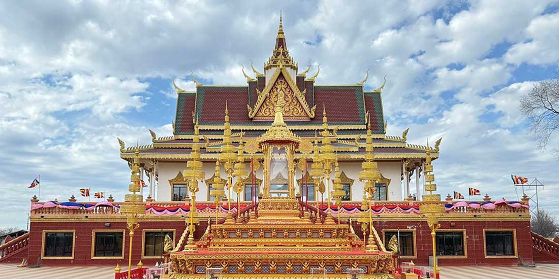
| It's called Gongsan Fortress. |
Frankly, though, I'm not sure how to divide up the three characters/syllables. A sanseong is a mountain fortress, so this could be Gong (Sanseong), i.e., Gong (Mountain Fortress). A seong, by itself can also be a castle of sorts, so this could be (Gong San) Seong, or (Gong Mountain) Castle/Fortress.
My Korean-savvy readers can leave intelligent explanations in the comments.
 |
| wider shot |
 |
| King Muryeong, Baekje monarch |
 |
| the king stands imperiously over the traffic circle |
 |
| the flames on the side of his head are probably emblematic of Buddhism |
Fire and flames are a common Buddhist motif, representing wisdom, divine consciousness, enlightenment, etc. Southeast Asian Buddhist temples and deities are often marked by flame-imagery. See here for a Thai example, and here for a Cambodian-style example.
Flames surrounding a divinity can also signify that divinity's wrathful aspect (e.g., here). Keep in mind that, in Buddhism, if you perceive a divinity as wrathful, it's your own internal state that's manifesting this, not anything objective. Buddhism is always about looking in a mirror to see what needs to be fixed. Your problems reside inside you.
 |
largest font: Gongju
font next to that: world-legacy city (segye yusan doshi/세계유산 도시) |
 |
| I pass this gate on the right. I think it's King Muryeong's gate. |
 |
| some ram-like entity at the gate |
 |
| lots of these new-but-old-style structures emphasizing the city's historical significance |
 |
"north": King Muryeong's burial mound
"south": Gongsan Fortress
"east": Geum River
"west": fortress market |
 |
| Into the structure I go. |
 |
| "King [Something] Bridge" |
 |
| looking out over the water |
 |
| similar structure across the street |
 |
| See Jesus up there? He sees you. |
 |
| Korea plays host to several major world religions and some crazy, home-grown ones. |
 |
| The beginning of a barrier with what looks like a phoenix head. |
 |
| raaaaawwwwwwwk |
 |
| banner apologizing for construction |
 |
| banner with construction info |
 |
| "Welcome to those who've come to Gongju." |
 |
| leaving the city center for quieter areas |
I now know I should've stopped my walk in the city center, where all of the convenience stores and restaurants are, along with some motels. Even though I liked the Crystal Motel, where I eventually ended up on this day, the motel's location wasn't convenient. I'd pay a little extra to be more centrally and comfortably located downtown.
 |
| I wonder how expensive such a barrier is. It's all heavy stone (but maybe metal-reinforced). |
 |
| reminiscent of a lantern-like structure |
 |
| the picturesque houses |
 |
| end of barrier—the other phoenix head |
 |
| squaaaawwwwwwk |
 |
| serious stare above another Buddhist-flame motif |
 |
| burning with insight |
 |
| Which way are you... headed? |
 |
| left and onward to Muryeong's burial mound (a park unto itself) |
 |
| no escaping the flames |
 |
| flaming and fructifying |
 |
| a look toward the king's burial mound |
 |
| I assume those are drainage channels. |
 |
| onward |
 |
| same stone as seen before, but a different place |
 |
| Ungjin Baekje Historical Museum (as it says in English) |
 |
| wider shot |
 |
| I have to walk through these grounds and out the other side to reach my motel. It's quieter for sure. |
 |
| up on top of the rise, then over a level patch, then downhill |
 |
| a re-creation of a fortress wall |
 |
| I guess I didn't document the downhill portion of the walk. |
 |
| colorful dilapidation near the motel |
 |
| "Motel," say the big syllables. "Crystal" say the little syllables. |
Korea's writing system is called hangeul (roughly, "script of the people"). It's an alphabet nowadays comprising 24 letters (there were way more letters at the outset in the 1440s). The letters are grouped into syllabic clusters, anywhere from two to about six letters per syllable. Read each syllable as a syllable. In many cases, these syllables are the Korean pronunciation of Chinese characters. About 70-80% of modern Korean is Chinese vocabulary. When Koreans write in Chinese (often to adopt a more serious, literate, or ornate tone, the way we might insert French or Latin or German into our written discourse), the Chinese characters are referred to as Sino-Korean characters because some of the characters' meanings have evolved on the peninsula, so they're no longer entirely Chinese. The Korean name for these written Sino-Korean characters is hanja. (A similar phenomenon in Japan is called kanji; both kanji and hanja come from the same two Chinese characters.)
When King Sejong and his councilors developed hangeul (originally called the Hunminjeongeum, or "proper sounds for the edification of the people"), they mostly based the writing of the letters on the way Chinese characters are written (why mess with a good thing?). So: stroke order is always right-to-left, up-to-down. Korean syllables are imagined as being written inside tiny, invisible, individual squares, thus restricting their size and proportions, just as Chinese characters are written. The placement of letters inside syllables follows the same rule: right-to-left, up-to-down.
So the letter "h" is ㅎ (pronounced "hieut").
The letter "ah" is ㅏ (pronounced "ah").
The letter "n" is ㄴ (prononced "nieun").
To spell "Han," then, put the letters together this way: 한, h-a-n.
Western words present a practical problem for Koreans because the rules for how vowels and consonants interact are so different between languages. So "hangeulizing" Western words can take a word with few syllables and turn it into a word with many syllables. Take Christmas, for example. Eight letters, but only two syllables in English. In Korean, it becomes keu-ri-seu-ma-seu, a five-syllable monstrosity: 크리스마스. But when those syllables are pronounced together quickly enough, the American ear will hear a recognizable "Christmas." So the inconvenience of foreign words is mostly in the writing of them, not the saying of them. But Crystal, as in Crystal Motel, presents a similar problem. In Korean, it's keu-ri-seu-tal, four syllables: 크리스탈. Luckily, as it is in English, Motel is only two syllables in Korean: mo-tel/모텔.
Learning Korean, for an English-speaker, means learning a ton of basics first. Once you get beyond those basics, the rest is much easier. Just remember to be mindful that most words have Chinese roots, so if you learn the roots, you can recognize the words more easily and even begin to catch new words based on what you already know. For the Japanese, learning Korean is a snap given the similarities in vocabulary, grammar, and cultural assumptions. It's a lot like how it is for Americans who learn Spanish or French or German: We too share a lot of idioms and cultural assumptions. For example if, in French, I say J'ai plusieurs fers dans le feu, that translates literally as I have several irons in the fire, which is the same metaphor with the same meaning in French as it is in US English ("I'm busy with multiple plans and projects"). But even though modern Korean has borrowed a ton of terminology from the English-speaking West (and words from other European languages as well), the idea of "shared cultural assumptions" is a lot more tenuous between Korean and American culture.
Anyway, Korean is part of my heritage, so I feel obliged to learn at least some it. Of course, I'm at war with myself because I'm also a lazy shit, and while soaking up French was easy for me when I was young, learning Korean required and requires a lot more effort, and I haven't been as studious as I should be. It's not that I no longer try; it's fairer to say that I should be trying a lot harder.
Anyway, below is the last shot for the day— the 크리스탈 모텔, where I stopped for what turned out to be two nights. Inconveniently, the nearest convenience store was across the street in a revamped hanok "hotel," and because the store was unstaffed, you needed a code to get in. I was lucky to arrive at the store's door right as someone was coming out, so I didn't have to figure out how to punch in. And that was my only foray into the convenience store for both nights.
 |
| 4:53 p.m. |
Had I started two hours earlier, I could have arrived a bit before 3 p.m. Had I had my wits about me, I could have found a motel downtown instead of out in the quiet parts of Gongju City. Would've, could've, should've—all the counterfactuals. At least I didn't stay where I had originally planned—the Geumgang Oncheon Motel, one building over (but not pictured). I saw it up close and instantly knew it would've been much more expensive. Then again, the Crystal, which was nice, turned out to have beds that were too soft, which ended up causing problems. There are always trade-offs.


A no-drama day is a good day. Keep 'em coming. That morning sun shot is exquisite.
ReplyDeleteNo photo of the biker crashing into the pile of refuse? That would have been artistic.
ReplyDeleteRight after the biker had extricated himself from the pile, he got back on his bike, and I took my picture of the pile. I belatedly wondered whether the biker had thought I was taking a picture of him. I know your comment was meant in jest, but for the record, I would never take a pic of such an embarrassing moment, most likely because I'd never like to have such a picture taken of me. Unless it was someone I hated doing a pratfall. Then I might be small-minded enough to snap such a picture.
DeleteGreat scenery shots, and I also like the historical structures. I didn't get the reference you made to the "Aragorn/Arwen bridge." Then again, you were seeing dwarves and elves, so I guess you were just experiencing "Middle Korea." Anyway, I appreciate the effort you put into taking and sharing all these photos. Sorry I couldn't be there to see it firsthand.
DeleteArched bridge.
Delete